|

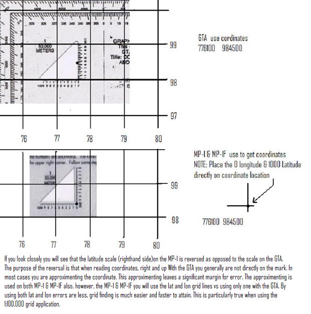
If
you look closely you will see that the latitude scale (righthand side)on the MP-1 is reversed as opposed to the scale on the
GTA.
The purpose of the reversal is that when reading coordinates, right and up With the GTA you generally are not directly
on the mark. In most cases you are approximenting the coordinate. This approximenting leaves a significant margin for error.
The approximenting is used on both MP-1 & MP-1F also, however, the MP-1 & MP-1F you will use the lat and lon grid lines vs
using only one with the GTA. By using both lat and lon errors are less, grid finding is much easier and faster to attain.
This is particularly true when using the 1:100,000 grid application.
|